


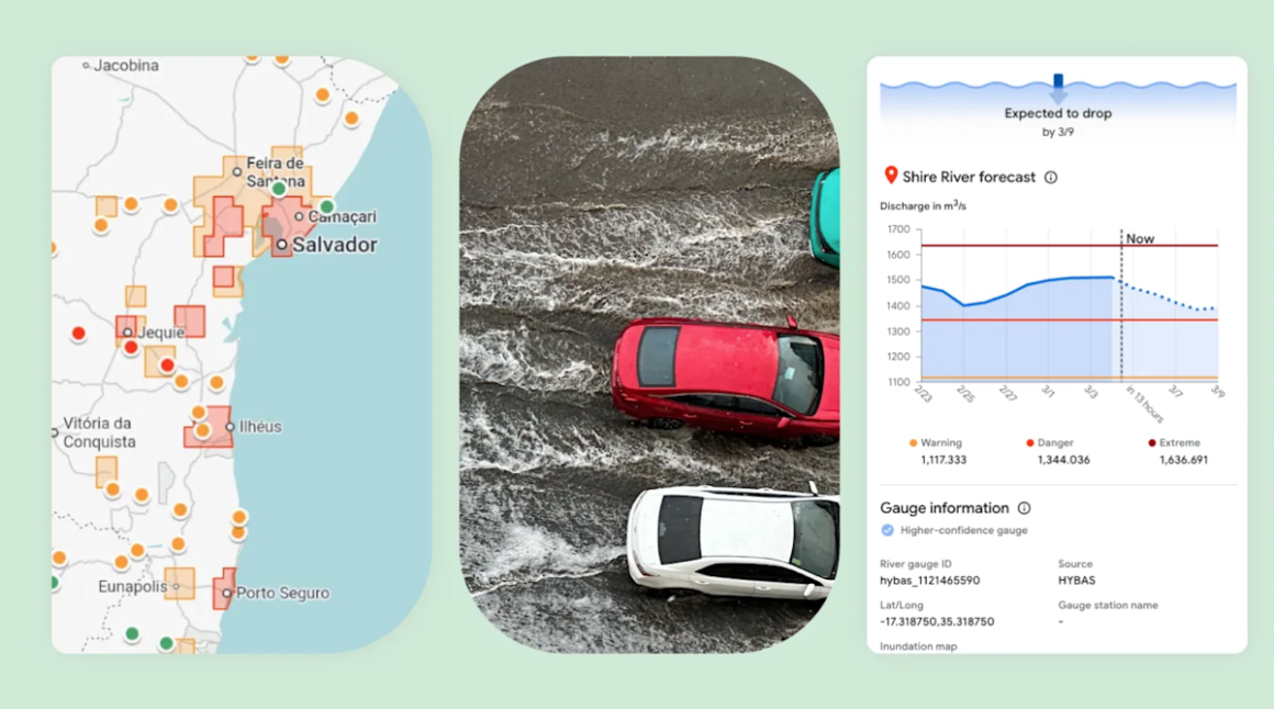
Google has introduced a new prediction tool called Groundsource, designed to help communities forecast flash floods using data from millions of old news reports. This tool leverages the Gemini AI model to analyze historical events, offering geo-tagged information and integrating with current weather forecasts to assess the risk of flash floods in various locations.
This development is significant for people living in areas prone to flash floods, especially those lacking advanced weather-sensing infrastructure. The tool aims to improve response times for emergency services by providing localized information for urban areas across 150 countries. However, the accuracy of this model is still untested, as concrete metrics for its predictive capabilities have not yet been disclosed.
In the broader market context, while Groundsource offers an innovative approach to flood prediction, it does face limitations. The model assesses risks within a 20-square-kilometer radius, and its efficacy is currently lower than systems provided by national meteorological services, which typically use local radar data for precise weather tracking. Current alternatives in the market include established services from national weather organizations that offer real-time flood alerts but may not be globally accessible, particularly in regions lacking resources.
For individuals in high-risk areas seeking improved flood risk assessments, Groundsource could be a valuable tool, especially for communities without effective forecasting resources. However, those looking for immediacy and precision in weather alerts may find more traditional weather services, with their radar and localized reporting, to be a better fit. It’s essential to weigh the technological novelty against the reliability of existing systems before deciding if this new tool meets your needs.
Source:
www.engadget.com